 how-to
Aerial Updates to Track Construction Progress
Table of Contents
- Why Clear Aerial Updates Matter for Architecture Firms
- Benefits of Aerial Construction Site Monitoring
- Drone Construction Progress Monitoring Best Practices
- Aerial Site Survey Frequency for Architecture Firms
- FAA Part 107 Drone Requirements for Construction
- How to Integrate Aerial Updates into Your Workflow
- Cost-Benefit Analysis for Small to Mid-Sized Firms
- Frequently Asked Questions
Last Updated: September 27, 2026
Why Clear Aerial Updates Matter for Architecture Firms
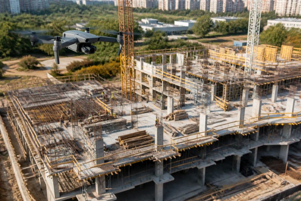
Architecture firms that rely on site visits and contractor photos to verify construction progress are working with a blind spot. Aerial construction updates to track construction job site progress for architecture firms close that gap, replacing scattered ground-level snapshots with a single, time-stamped visual record of the entire site. Firms that adopt scheduled aerial documentation catch layout deviations earlier, answer client questions faster, and walk into every site meeting already knowing what changed.
The reason is simple. A ground photo shows you one wall. An aerial view shows you the whole site at once, including the relationship between the building footprint, staging areas, and site topography.

Here's what most guides get wrong: they frame drones as a marketing tool for real estate listings. For architects, the value is operational. Aerial construction updates feed design verification, compliance tracking, and stakeholder communication throughout the construction lifecycle, not just at handover.
Benefits of Aerial Construction Site Monitoring
The benefits of aerial construction site monitoring fall into two categories: what you see in real time, and what the record protects you against later. Both matter, but most firms underinvest in the second.
Real-Time Data and Project Transparency
Real-time aerial data turns a weekly site walk into a continuous visual log. Instead of waiting for a contractor's progress report, you review current imagery and compare it against the previous flight. That comparison surfaces problems while they're still cheap to fix.
Project transparency improves on the client side too. Sharing a dated aerial image with a remote stakeholder answers more questions than a written update ever will. It also reduces the back-and-forth that eats into billable design time.
Time-Stamped Records and Risk Mitigation
Time-stamped records are the quiet workhorse of aerial documentation. Every flight produces imagery tied to a specific date, which builds a defensible visual history of the site. If a dispute arises over what was built when, that record does the talking.
Risk mitigation works the same way. Aerial imagery documents site conditions before, during, and after each phase, which supports quality assurance and gives your firm a factual basis for any claim or change order discussion.
Drone Construction Progress Monitoring Best Practices
Good drone construction progress monitoring best practices come down to consistency. The imagery is only useful if each flight captures the site the same way, from the same angles, at a comparable altitude.
Planning Flights and Ground Control Points
Plan every flight around a fixed set of waypoints. Ground control points, or GCPs, are physical markers on the site with known coordinates that anchor your imagery to real-world positions. Without them, your maps drift.
A practical setup:
- Place GCPs at the site corners and at least two interior points
- Record each marker's coordinates before the flight
- Fly the same path and altitude on every visit
- Capture overlapping images, roughly 70 to 80 percent overlap, for clean photogrammetry
Processing Data for BIM integration
Processing turns raw images into usable outputs. Photogrammetry software stitches the photos into orthomosaic maps and 3D models, which you can then reference against your design files.
BIM integration is where this pays off for architects. Overlaying an orthomosaic against your model shows whether the structure matches design intent. As-built documentation built from aerial data gives you a reliable record for closeout, and it takes far less time than manual measurement.
Aerial Site Survey Frequency for Architecture Firms
Aerial site survey frequency for architecture firms depends on project phase, not a fixed calendar. A single schedule rarely fits every job.
| Project Phase | Recommended Frequency | Primary Purpose |
|---|---|---|
| Pre-construction | One baseline flight | Site topography and existing conditions |
| Foundation and framing | Weekly to biweekly | Structural progress verification |
| Active construction | Monthly | Progress monitoring and client updates |
| Pre-closeout | One final flight | As-built documentation and handover |
Fast-moving phases justify more frequent flights. Slower phases don't need weekly coverage. For most small to mid-sized firms, a monthly baseline with extra flights during critical phases can help keep costs predictable while still capturing the record needed.
FAA Part 107 Drone Requirements for Construction
FAA Part 107 drone requirements for construction govern who can legally fly for commercial purposes. Any drone flight tied to a business activity, including site documentation, requires a Remote Pilot Certificate under Part 107.
The key points for architecture firms:
- The pilot must hold a current Remote Pilot Certificate
- The drone must be registered if it weighs over 0.55 pounds
- Flights must stay within visual line of sight of the pilot
- Operations over people and in controlled airspace carry additional restrictions
You can review the full rule set through the FAA's Part 107 small unmanned aircraft overview. For most firms, the practical answer is to work with a certified operator rather than train in-house staff. It's faster, and it shifts the compliance burden to the operator.
How to Integrate Aerial Updates into Your Workflow
Integrating aerial data into an existing architectural workflow doesn't require new software or a dedicated staff member. It requires a defined process.
- Set your flight schedule by phase. Match frequency to the table above.
- Standardize your flight path. Same waypoints, same altitude, every visit.
- Route imagery to cloud-based collaboration. Shared folders keep the whole team working from the same files.
- Overlay against your BIM model. Compare design intent to current conditions.
- Attach dated imagery to project updates. Client reports and internal reviews both benefit.
- Archive by phase. Keep the record organized for closeout and any future dispute.
The firms that get the most from aerial data treat it as a routine part of project management, not a one-off service. That's the difference between a folder of drone photos and a usable visual record.
Cost-Benefit Analysis for Small to Mid-Sized Firms
Small and mid-sized firms often assume aerial monitoring is priced for large developers. In practice, the cost of a single missed issue can outweigh the cost of regular documentation.
Consider what aerial updates replace or reduce:
- Fewer dedicated site visits for progress verification
- Faster resolution of client and contractor questions
- A defensible record that reduces dispute exposure
- Less time spent chasing photos from subcontractors
For a firm running two or three active projects, a monthly flight schedule can be a modest line item compared to the billable hours it can save. Pricing depends on project scope, flight frequency, and delivery timeline, so it's worth requesting a quote based on your actual schedule rather than assuming a flat rate.
This is where a firm like Lake County Aerial Solutions fits. FAA Part 107 certified operations, fully insured flights, and 24-hour delivery mean the imagery lands in your inbox while it's still relevant. The DJI Air 3S captures the detail needed for roof reports, square footage, and progress documentation, and custom 3D-printed drone accessories are available to keep equipment tuned to the job.
Frequently Asked Questions
What specific data can be captured in aerial construction site reports?
Aerial reports capture orthomosaic maps, 3D models, volume calculations, and time-stamped visual records. Photogrammetry creates as-built documentation that integrates with BIM software. You also get site topography data, progress comparisons, and compliance tracking. These outputs support project management, stakeholder communication, and quality assurance throughout the construction lifecycle.
How often should architecture firms schedule aerial site progress updates?
Frequency depends on project phase and complexity. For active construction, monthly updates work for most firms. Fast-track projects may need biweekly or weekly flights. During critical milestones like groundbreaking or closeout, schedule updates around those events. Aerial site survey frequency for architecture firms should balance data needs with budget and FAA Part 107 operational limits.
What are the FAA Part 107 drone requirements for construction site flights?
FAA Part 107 requires remote pilots to hold a current certificate, register drones over 0.55 pounds, and follow operational rules like flying below 400 feet and within visual line of sight. Construction sites often need airspace authorization if near airports. You must also avoid flying over people not involved in the operation. Hiring a certified provider ensures compliance and reduces liability.
How do aerial updates improve construction project management?
Aerial updates give project managers real-time data on progress, helping identify delays early. Time-stamped records create accountability and support risk mitigation. Cloud-based collaboration lets stakeholders review visual documentation remotely. Integration with BIM and project management tools keeps workflows connected. This transparency improves decision-making and reduces costly rework.
Construction schedules move faster than most firms can document them, and the gap between design intent and as-built reality is where disputes and rework live. Clear, dated aerial updates close that gap. Lake County Aerial Solutions provides FAA Part 107 certified flights, fully insured operations, accurate roof and site measurements, and delivery within 24 hours so your team always has current imagery in hand. Request a free quote and get the visual record your next project deserves.