 ultimate-guide
Drone Construction Progress Tracking Services: 2026 Guide
Table of Contents
- What Drone Construction Progress Tracking Services Include
- Software and Platforms for Construction Drone Progress Monitoring
- Construction Site Drone Mapping: Orthomosaics and 3D Models
- Construction Progress Photos From Drones: What Makes Them Useful
- Drone Survey Frequency for Construction: How Often to Fly
- How to Choose a Drone Construction Tracking Provider
- Accuracy, FAA Rules, and Data Privacy for Drone Construction Tracking
- Conclusion: Getting Started With Drone Progress Tracking
- Frequently Asked Questions
Last Updated: October 5, 2026
What Drone Construction Progress Tracking Services Include
Drone construction progress tracking services use FAA Part 107 certified pilots to capture scheduled aerial imagery of an active job site, then turn that imagery into maps, models, and dated progress reports that show exactly what changed since the last flight.
The core problem these services solve is simple: a superintendent's phone photos are inconsistent, and a ground walk can't show 40 acres of earthwork in one view. A drone can.
Drone construction progress tracking services is a recurring engagement, not a one-time shoot. You're buying a visual record that compounds in value every month.
Deliverables: Maps, Models, and Progress Reports
Most providers bundle three output types. Knowing which one you actually need keeps the scope, and the schedule, sane.
- Aerial imagery sets: geotagged, high-resolution stills organized by flight date
- Orthomosaic maps: a single flattened, measurable image of the whole site
- 3D models: surface and structure models for volume and elevation checks
Software and Platforms for Construction Drone Progress Monitoring
Construction drone progress monitoring runs on a platform, and the platform choice usually outlives the drone. Most firms fly DJI hardware and process in one of a handful of established tools.
Birdi, DroneDeploy, Propeller Aero, PIX4Dcloud, PIX4Dmapper, and DJI Progress Management all appear in construction-focused comparisons. They differ mainly in how they handle progress comparison, team collaboration, and site documentation. FAA Part 107 Small Unmanned Aircraft Rule overview
What Actually Separates These Platforms
Three functional differences matter more than brand:
- Progress comparison method: Some platforms auto-align two flight dates and generate a change-detection view; others require you to manually overlay captures. Auto-alignment saves hours on multi-phase sites.
- Measurement and volume tools: Earthwork-heavy projects need cut-and-fill volume calculations and stockpile measurements. Not every platform exposes those tools at every tier.
- Collaboration and permissions: Owner, lender, and subcontractor access is often the deciding factor. Look for role-based sharing, comment threads on specific captures, and export formats your team can drop into existing reports.
Selection Checklist: Matching Platform to Project
Before committing to a platform, run these checks against your actual workflow:
- Does it accept the image formats your pilot's drone produces?
- Can it align two or more flight dates automatically?
- Does it export orthomosaics, 3D models, and PDF progress reports?
Comparison Table: Pricing and Best-Fit Use Cases
| Platform | Reported Starting Price | Best For | Free Tier |
|---|---|---|---|
| Birdi | $287/month | Progress reporting software | No |
| DroneDeploy | Contact for pricing | General drone mapping workflows | No |
| Propeller Aero | Contact for pricing | Site mapping and data collection | No |
| PIX4Dcloud | Contact for pricing | Online mapping and documentation | No |
| PIX4Dmapper | Contact for pricing | Desktop photogrammetry processing | No |
| DJI Progress Management | Contact for pricing | Visual tracking with team collaboration | No |
Pricing above is reported from supplied search results and vendor pages, not quoted rates. Confirm current terms directly. Most platforms price by seat, by project, or by processing volume, so the same tool can cost very differently depending on how many active sites you run.
Subscription Versus Per-Flight Models
Two pricing structures dominate the market:
- Subscription: A monthly or annual platform fee, often plus a per-flight or per-acre processing charge. Best when you capture weekly and want unlimited team access.
- Per-flight: You pay per capture or per deliverable, with no platform commitment. Best for monthly cadence or short-duration projects.
Project size and capture frequency drive the math. A 40-acre site flown weekly generates far more processing volume than a 2-acre infill lot flown monthly, and most platforms price accordingly. Ask for a quote at your actual acreage and cadence, not a generic rate card.
Construction Site Drone Mapping: Orthomosaics and 3D Models
Construction site drone mapping produces two workhorse outputs. An orthomosaic is a geometrically corrected aerial image stitched from hundreds of overlapping photos, scaled so distances and areas can be measured directly on it.
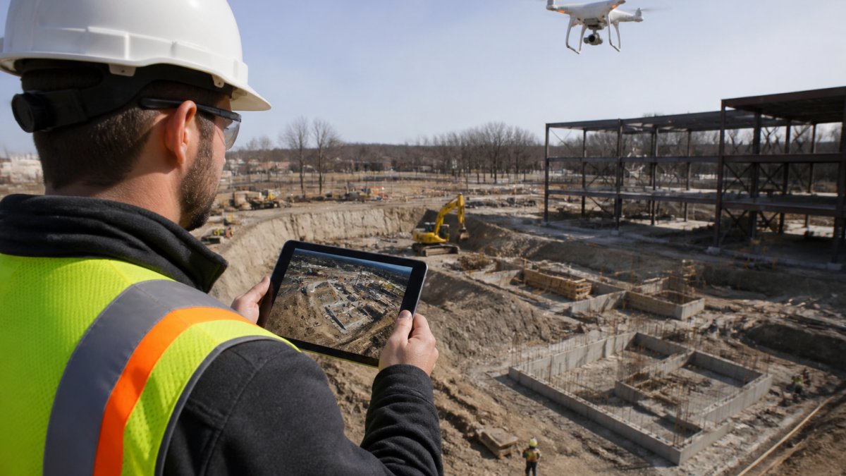
The practical difference: orthomosaics answer "what's built and where." 3D models answer "how much dirt moved." For earthwork-heavy phases, you want both.
Construction Progress Photos From Drones: What Makes Them Useful
Construction progress photos from drones are useful when they're repeatable. The value isn't in any single image; it's in shooting the same angles, at the same altitude, on a fixed schedule so two dates can be laid side by side without guesswork.
Manual photo logs fail here. A pilot who free-flies each visit produces images that look fine alone and useless in comparison. Automated flight paths fix that.
What separates a usable progress photo set:
- Consistent altitude, heading, and camera angle per capture
- Geotags on every image
- A named flight date and project phase
Drone Survey Frequency for Construction: How Often to Fly
Drone survey frequency for construction typically runs weekly during active structural work and monthly during slower phases. The right cadence tracks your schedule, not a vendor's package.
| Project Phase | Recommended Cadence | Primary Use |
|---|---|---|
| Site prep and earthwork | Weekly | Volume tracking, cut-and-fill |
| Foundation and structure | Weekly to biweekly | Milestone verification |
| MEP and interior rough-in | Monthly | Owner and lender updates |
| Closeout | One final flight | As-built documentation |
How to Choose a Drone Construction Tracking Provider
Choosing a drone construction tracking provider comes down to five checks: certification, insurance, turnaround, deliverable format, and whether they understand construction schedules.
The certification and insurance questions are not formalities. A provider operating without a current Part 107 certificate or without liability coverage puts your project's risk on you, not them.
- Current FAA Part 107 certificate on file
- Certificate of insurance with limits that match your contract requirements
- Guaranteed turnaround time in writing
Lake County Aerial Solutions meets these checks: FAA Part 107 certified, fully insured, and delivering accurate drone data within 24 hours using equipment like the DJI Air 3S.
Accuracy, FAA Rules, and Data Privacy for Drone Construction Tracking
Accuracy depends on three inputs: image overlap, ground control, and processing settings. Most reputable workflows land within a few centimeters horizontally when ground control points are used, and drift noticeably without them. That drift is not a rounding error, on a large parcel it can be enough to make a volume claim wrong.
How Accuracy Is Actually Achieved and Validated
Photogrammetry measures relative positions from overlapping images. Without an external reference, those positions are internally consistent but not tied to the real world. Three mechanisms fix that:
- Ground control points (GCPs): Marked targets surveyed with a known coordinate, visible in the imagery. The processing software uses them to anchor the model.
- RTK/PPK positioning: A GPS-corrected drone tags each image with centimeter-level coordinates at capture, reducing or eliminating the need for physical GCPs.
- Check shots: Independent points surveyed but not used in processing, then compared against the model to verify accuracy. If check shots don't match, the model isn't ready to measure from.
A common validation pattern is to require a check-shot report with every deliverable. That report tells you the actual error at known points, not a marketing claim.
What Limits Accuracy
Even a well-controlled flight has limits:
- Weather: Wind, haze, and low sun angle degrade image quality and stitching.
- Occlusion: Trees, equipment, and structures hide ground surfaces. A model can't measure what it can't see.
- Surface texture: Freshly graded dirt, water, and reflective roofs process poorly.
Interpretation matters as much as measurement. A 3-centimeter horizontal accuracy figure doesn't mean every volume calculation is accurate to 3 centimeters, volume error compounds with surface area and elevation change.
FAA Rules for Commercial Drone Operations
Commercial drone operations fall under the FAA's Part 107 framework, which governs pilot certification, altitude limits, and operations over people. Construction sites near airports or in controlled airspace may require additional authorization before any flight. FAA guidance on operating drones near airports
For a construction buyer, the practical compliance questions are:
- Is the pilot's Part 107 certificate current?
- Does the operator hold a waiver or authorization for any controlled airspace over the site?
- Is there a site-specific safety plan that coordinates with the general contractor's daily operations?
Data Privacy, Ownership, and Storage
Data privacy is the piece most buyers overlook. Aerial captures can include neighboring properties, workers, and adjacent sites. Ask how a provider stores footage, who can access it, and how long it's retained. NIST Cybersecurity Framework overview
Three questions to settle in the contract:
- Ownership: Who owns the raw imagery, the processed models, and the derived reports? Most buyers want full ownership of all deliverables.
- Access: Who on the provider's team can view your site data, and under what permissions?
- Retention and deletion: How long is data stored, where, and can you request deletion at project closeout?
ROI and Measurable Outcomes
The business case for recurring drone tracking rests on measurable indicators, not aesthetics:
- Reporting time: Replacing manual photo compilation and site walks with automated deliverables.
- Rework: Catching deviations before they're buried under subsequent work.
- Schedule variance: Comparing actual progress against planned milestones using dated captures.
Track these against your baseline before and after adopting a capture schedule. The value shows up in the reporting cycle, not the flight itself.
Conclusion: Getting Started With Drone Progress Tracking
The hardest part of drone progress tracking isn't the flying. It's committing to a schedule and a repeatable flight path so the data actually compares month over month.
Lake County Aerial Solutions handles the whole loop: FAA Part 107 certified flights, accurate roof reports with square footage and edge measurements, clear aerial updates to track job site progress, and data delivered within 24 hours.
Request a free quote and we'll scope a capture schedule around your project phases.
Frequently Asked Questions
How do drones track construction progress?
Drones fly pre-programmed flight paths over a construction site and capture high-resolution aerial imagery at set intervals. That imagery is processed into orthomosaic maps, 3D models, and time-series comparisons. Site managers review these outputs to see what changed since the last flight, spot delays, and document milestones. Automated analysis and AI-powered monitoring tools can flag deviations from schedule or design, giving teams real-time insights without sending someone to walk the site.
What do drone construction progress tracking services include?
Most services cover flight planning, on-site data capture, image processing, and delivery of outputs such as orthomosaic maps, 3D models, progress reports, and as-built records. Some providers add comparative analysis, delay detection, and integration with construction software or BIM models. Lake County Aerial Solutions, for example, delivers accurate drone data within 24 hours, which matters when a project milestone or client update is due. Deliverables vary by provider, so confirm exactly what you receive before signing.
How often should a construction site be surveyed by drone?
Survey frequency depends on project pace and reporting needs. Fast-moving projects with daily earthwork changes often benefit from weekly captures, while slower builds may only need monthly captures. Some teams schedule flights around construction milestones or billing cycles. A practical starting point is weekly during active site work and monthly during finishing phases. Discuss your schedule with your provider; they can adjust frequency as the project progresses without locking you into a rigid plan.
What deliverables can construction teams get from drone progress monitoring?
Typical deliverables include orthomosaic maps, 3D models, aerial progress photos, time-series imagery, cut-and-fill analysis, and as-built orthomosaics. Some platforms add automated progress reports and delay detection. These outputs support construction reporting, schedule tracking, and team collaboration across office and field staff. For owner updates or lender draw requests, visual records from drones provide objective evidence of site conditions at a specific date, which is harder to dispute than manual photo logs.
Can drone imagery be compared with construction plans or BIM models?
Yes. Many drone mapping platforms let you overlay orthomosaic maps or 3D models onto design plans or BIM models. This comparative analysis shows whether built work matches the design and helps catch deviations early. Integration with construction software and BIM workflows is available from several providers, though the depth of integration varies. If plan comparison is a priority, ask vendors specifically how their platform handles BIM overlays and what file formats they support.
How much do construction drone monitoring services cost?
Pricing depends on site size, capture frequency, deliverable type, and processing needs. Service-based providers often price per flight or per project. Lake County Aerial Solutions lists pricing on its website, so you can see current rates without a sales call. Request a quote with your project details for an accurate figure.
What should I look for when choosing a construction drone service?
Check FAA Part 107 certification, insurance coverage, turnaround time, and the specific deliverables you need. Ask whether the provider offers orthomosaic maps, 3D models, and time-series comparisons, or just raw photos. Confirm they can handle your service area and project size. Also review data-sharing and privacy practices. A provider that delivers accurate data within 24 hours and carries full insurance reduces risk on both the schedule and liability sides.
Are drone flights for construction sites subject to FAA rules?
Yes. Commercial drone operations in the U.S. fall under FAA Part 107, which requires remote pilot certification, aircraft registration, and adherence to airspace restrictions. Flying over active construction sites may also involve coordination with site safety officers and compliance with local ordinances. A qualified provider handles these requirements, carries liability insurance, and can provide documentation. Always confirm your provider's certification and insurance before authorizing flights over your project.