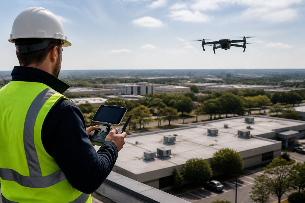
 ultimate-guide
Professional Aerial Photography for Commercial Properties
Table of Contents
- What Professional Aerial Photography Does for Commercial Properties
- ROI and Financial Impact of Aerial Imagery for Property Marketing
- FAA Part 107 Drone Photography Requirements and Compliance
- Drone Roof Inspection Reports for Commercial Buildings
- Aerial Construction Progress Monitoring for Active Job Sites
- Commercial Real Estate Drone Photography Pricing and Service Models
- How to Choose the Right Aerial Photography Provider
- Frequently Asked Questions
Last Updated: September 25, 2026
What Professional Aerial Photography Does for Commercial Properties
Professional aerial photography for commercial properties reveals the full scope of a property, building footprint, parking areas, surrounding infrastructure, and site layout, in ways ground-level photos cannot.
Commercial real estate decisions hinge on context: a warehouse's value depends on highway and rail access; a retail location's on visibility and traffic patterns. Only aerial imagery reveals these factors. Lake County Aerial Solutions delivers the comprehensive visual evidence decision-makers need.
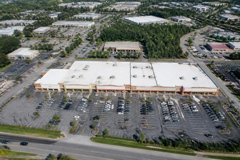
Applications span multiple industries: real estate agents showcase property scale and location context; construction firms track job site progress; property managers assess roof conditions safely; land developers evaluate terrain and development potential.
Effective aerial imagery requires precision: high-resolution sensors, consistent flight paths for accurate comparisons, and professional post-production. Equipment matters, a DJI Air 3S delivers the resolution and stability commercial applications demand.
ROI and Financial Impact of Aerial Imagery for Property Marketing
The financial case for professional aerial photography rests on measurable outcomes across three distinct commercial property scenarios: faster market absorption, higher offer confidence, and reduced financing friction.
Faster Market Absorption and Reduced Days-on-Market
Properties with comprehensive aerial documentation move faster because remote buyers, especially institutional investors evaluating land, industrial, or retail parcels, cannot visit in person. Aerial imagery eliminates the information gap that typically requires multiple follow-up visits. A buyer reviewing a 10-acre industrial parcel can immediately assess highway proximity, rail access, and site layout. Without it, they request a site visit or move to the next listing. Reducing evaluation timelines from weeks to days has measurable financial value.
Offer Confidence and Bid Competitiveness
Aerial documentation reduces valuation uncertainty and attracts higher-confidence offers. A buyer evaluating a 50,000-square-foot warehouse can see roof condition, parking layout, and loading dock configuration, reducing contingencies. Without this information, buyers build in larger uncertainty buffers, resulting in lower offers or more restrictive terms.
Lenders reviewing development projects want objective evidence of progress. Weekly or monthly aerial documentation accelerates loan fund releases tied to milestones, reduces perceived risk, and enables better financing terms.
Valuation Accuracy and Bid Consistency
Professional aerial roof reports standardize contractor information, reducing bid variability from 20-40 percent to a consistent baseline. Without this documentation, contractors estimate from ground level, creating uncertainty and delaying decisions.
Property managers with documented roof reports can prioritize repairs and plan capital expenditures accurately. Deferred maintenance based on incomplete information often costs 2-3 times more than planned maintenance.
Financing and Insurance Claims
Pre-event aerial documentation accelerates insurance claims and reduces disputes about pre-existing conditions. For commercial properties, this documentation can mean the difference between claim approval and denial.
Properties with professional aerial documentation sell faster, attract higher-confidence offers, and close with fewer contingencies. The cost is offset by accelerated timelines and reduced valuation uncertainty.
FAA Part 107 Drone Photography Requirements and Compliance
Operating a drone commercially requires FAA Part 107 certification. Any business charging for drone services must employ a Remote Pilot in Command holding this certificate.
Certification requires passing a rigorous knowledge test covering airspace rules, weather, aircraft performance, and emergency procedures. Certified pilots understand the regulatory landscape.
Compliance requires staying within visual line of sight, avoiding flight over people or moving vehicles, maintaining 400-foot altitude limits, and prohibiting night operations without waivers.
For commercial properties in complex environments, near airports, in congested airspace, or with obstacles, compliance becomes more involved. Some sites require airspace waivers or special permissions. Lake County Aerial Solutions manages these requirements as part of service delivery, not as an afterthought. Understanding which properties need additional coordination and obtaining necessary approvals before scheduling prevents delays and ensures legal operation.
Insurance requirements accompany certification. Professional operators carry general liability coverage protecting against property damage or injury claims. This matters for clients who hire drone services, they need assurance that the operator carries sufficient coverage and that their property is protected during aerial work.
Drone Roof Inspection Reports for Commercial Buildings
Ground-level roof inspections are incomplete, inspectors miss central sections, flashing details, and the actual extent of wear or damage.
Drone roof inspection reports document the entire roof surface, including areas requiring expensive ladder or crane access. Measurements provide accurate square footage, edge conditions, and material assessment.
Professional roof inspection reports include orthomosaic imagery with accurate measurements derived from calibrated aerial data. Damage areas are annotated and material conditions documented systematically, providing objective evidence for insurance claims, bids, or financing.
Professional aerial inspection reports use consistent methodology and documented measurement standards, reducing variability that plagues ground-based estimates.
Aerial Construction Progress Monitoring for Active Job Sites
Regular aerial documentation serves multiple purposes: financing verification, stakeholder communication, timeline validation, and dispute prevention.
Aerial progress documentation provides objective evidence that work advances according to schedule, accelerating fund releases tied to milestones.
Regular aerial updates create a visual timeline and independent record, protecting both contractors and property owners in case of disputes.
Aerial imagery captures equipment placement, material staging, foundation progress, and framing stages, providing remote stakeholders confidence that the project is advancing.
Frequency depends on project needs, weekly for large developments, monthly for smaller projects. Consistency matters more than frequency.
Commercial Real Estate Drone Photography Pricing and Service Models
Pricing for professional aerial photography varies based on scope, complexity, deliverable specifications, and turnaround time. Understanding the cost drivers helps commercial property owners evaluate quotes and ensure they're purchasing the right service for their needs.
Primary Cost Drivers
Property size and complexity form the foundation of pricing. A 5-acre lot costs less than a 50-acre industrial complex. Site access constraints, proximity to highways or airport airspace, require additional coordination and increase labor costs.
Deliverables significantly influence pricing. A basic aerial photography session (20-30 high-resolution still images with standard color correction) costs less than a comprehensive package that includes orthomosaic imagery, roof inspection reports with calibrated measurements, or video content. Orthomosaic imagery, a stitched, georeferenced composite that functions like a map, requires multiple overlapping flight passes and specialized post-processing software. A professional roof inspection report with annotations, material assessment, and square footage calculations requires additional analysis beyond standard image delivery.
Turnaround time is a direct cost multiplier. Standard turnaround (3-5 business days) allows the photographer to batch multiple projects and optimize editing workflow.
Typical Service Models and Price Ranges
What Affects Quote Variability
Evaluating Pricing Against Deliverable Quality
How to Choose the Right Aerial Photography Provider
Not all aerial photography services deliver equivalent quality or reliability. The differences matter.
Frequently Asked Questions
How quickly can professional aerial photography for commercial properties be delivered?
Turnaround time depends on project scope and post-production requirements. Lake County Aerial Solutions delivers accurate drone data within 24 hours. Always confirm turnaround expectations before booking to ensure the timeline matches your deadline.
What FAA Part 107 drone photography requirements apply to commercial property shoots?
FAA Part 107 certification requires the drone pilot to maintain visual line of sight, operate during daylight, stay below 400 feet altitude, and avoid flying over people or populated areas without a waiver. Commercial property photography must comply with these rules even on private land. Your provider should carry Part 107 certification and liability insurance. Complex sites near airports or restricted airspace may require additional FAA approvals, which a certified operator can arrange.
How accurate are drone roof inspection reports for commercial buildings?
Professional drone roof inspection reports use high-resolution imagery and precise measurement tools to calculate square footage and document edge conditions. Accuracy depends on equipment quality, flight altitude, and post-production processing. Reputable providers use calibrated equipment and compare measurements against known reference points. Always request methodology details and ask if reports include edge measurements, ridge counts, and photographic evidence, not just numbers. This level of detail supports confident roof maintenance planning and insurance claims.
What's included in a professional aerial photography package for commercial real estate?
Standard packages typically include high-resolution still imagery, edited photos, and delivery within 24-48 hours. Premium packages add drone videography, oblique and top-down perspectives, and color grading. Custom 3D-printed drone accessories are available. Some providers offer construction progress documentation packages with timestamped imagery for job site monitoring. Review what editing and file formats are included, raw files, print-ready files, and web-optimized versions all serve different purposes. Request samples to compare quality and editing standards before committing.
How does aerial photography improve commercial property listing performance?
Aerial imagery showcases site layout, building footprint, parking areas, and surrounding infrastructure in ways ground-level photography cannot. This visual storytelling helps remote buyers and investors understand property context and development potential. Listings with drone photography typically receive more inquiries and sell faster than those with ground-level photos alone. The aerial perspective also reveals zoning relationships, access routes, and neighboring commercial development, all critical factors for informed decision-making. High-resolution aerial media works across print brochures, digital marketing, and property portals.
Is aerial photography worth the investment for small commercial properties?
Yes, even smaller properties benefit from aerial perspective. A single aerial photo can showcase parking, landscaping, and site access more effectively than multiple ground shots. The ROI comes from faster lead generation, higher inquiry quality, and reduced showing time because buyers understand the property layout upfront. Small developers and property managers should compare pricing for single-shoot packages rather than assuming aerial work requires a large budget.
What equipment and technical specifications matter most in professional aerial photography?
Look for providers using enterprise-grade drones with full-frame or high-resolution sensors, capable of shooting in RAW format for better post-production control. Wide-angle lenses (24mm equivalent or wider) capture more context. The DJI Air 3S and similar platforms offer high resolution, extended flight times, and reliable stabilization. Ask about flight planning software, which ensures consistent framing and coverage. Post-production matters equally, color grading, sharpening, and perspective correction separate professional results from amateur shots. Request sample images shot in similar lighting conditions to your project.
Choosing professional aerial photography for commercial properties requires balancing cost, quality, reliability, and regulatory compliance. The investment pays dividends when it accelerates sales cycles, prevents costly estimation errors, or provides objective documentation that protects all parties. Request a free quote from Lake County Aerial Solutions to discuss your specific needs and learn how professional aerial imagery can support your next project.